http://www.boston.com/bigpicture/2009/11/martian_landscapes.htmlSince 2006, NASA's Mars Reconnaissance Orbiter (MRO) has been orbiting Mars, currently circling approximately 300 km (187 mi) above the Martian surface. On board the MRO is HiRISE, the High Resolution Imaging Science Experiment camera, which has been photographing the planet for several years now at resolutions as fine as mere inches per pixel. Collected here is a group of images from HiRISE over the past few years, in either false color or grayscale, showing intricate details of landscapes both familiar and alien, from the surface of our neighboring planet, Mars. I invite you to take your time looking through these, imagining the settings - very cold, dry and distant, yet real. (35 photos total)
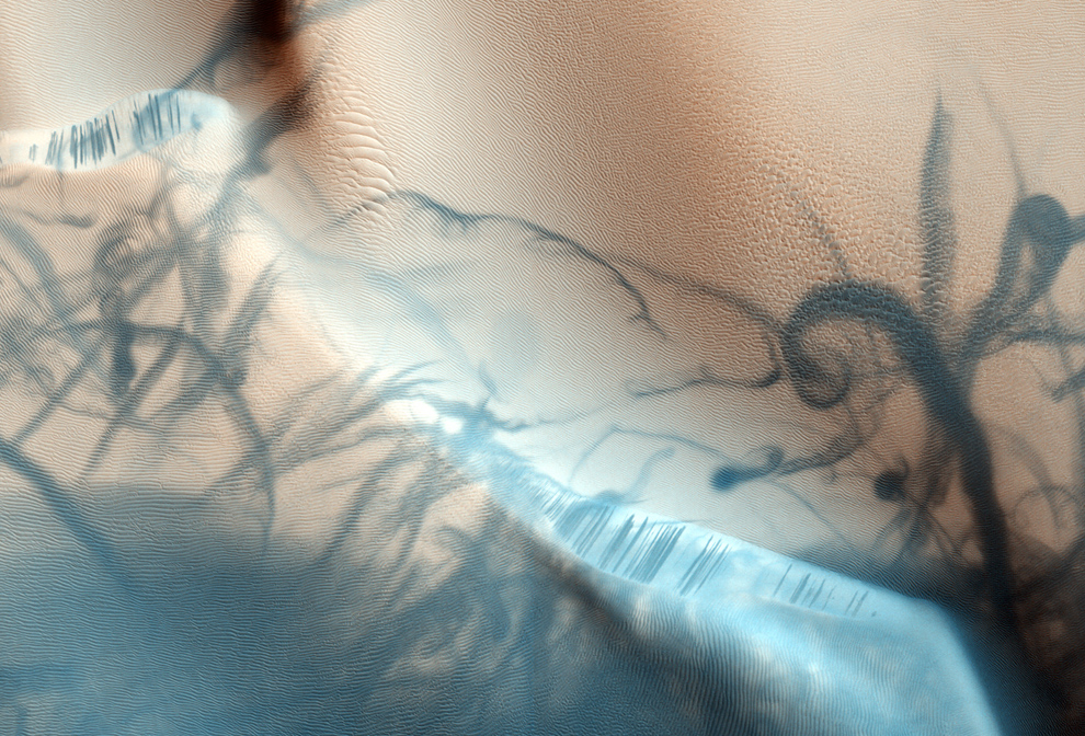
1 Intersecting swirling trails left by the earlier passage of dust devils across sand dunes, as they lifted lighter reddish-pink dust and exposed the darker material below. Also visible are darker slope streaks along dune edges, formed by a process which is still under investigation. More, or see location on Google Mars. (NASA/JPL/University of Arizona)
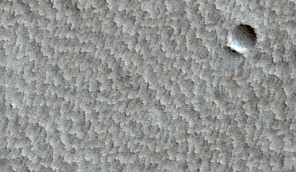
2 An eroded crater in a larger plain with a scalloped appearance near Pavonis Mons. More, or see location on Google Mars. (NASA/JPL/University of Arizona) #
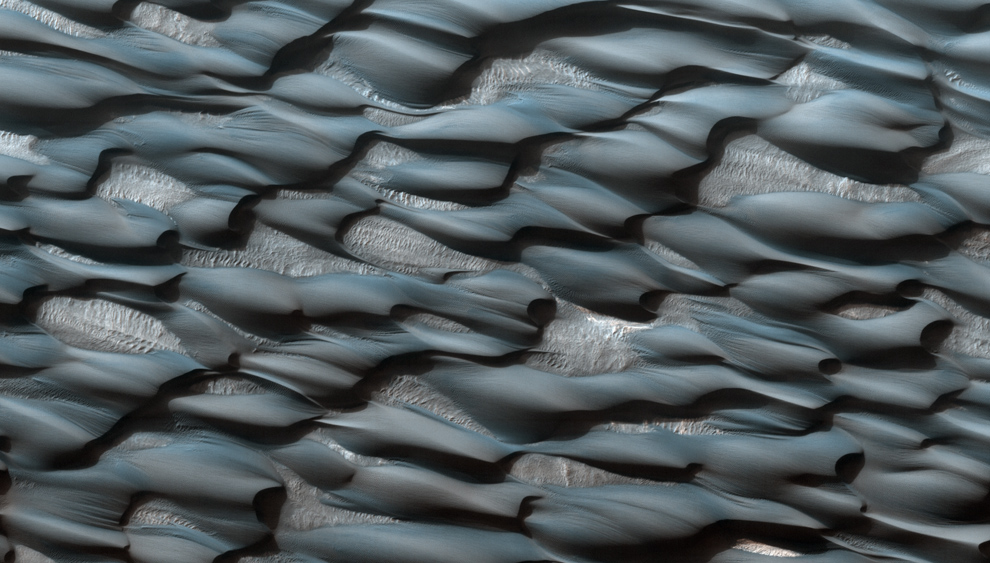
3 Part of the Abalos Undae dune field. The sands appear blueish because of their basaltic composition, while the lighter areas are probably covered in dust. More, or see location on Google Mars. (NASA/JPL/University of Arizona) #
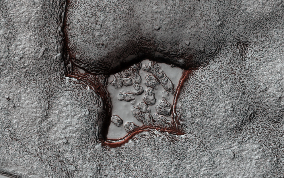
4 A portion of the Martian South Polar Cap, showing stratified layers exposed by a long process of sublimation. More information here. (NASA/JPL/University of Arizona) #
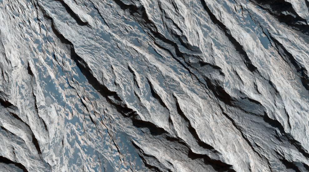
5 Exposure of Layers and Minerals in Candor Chasma. This image shows a cliff along a light-toned layered deposit in Valles Marineris. Erosion by wind has carved V-shaped patterns along the edges of many of the layers. More, or see location on Google Mars. (NASA/JPL/University of Arizona) #
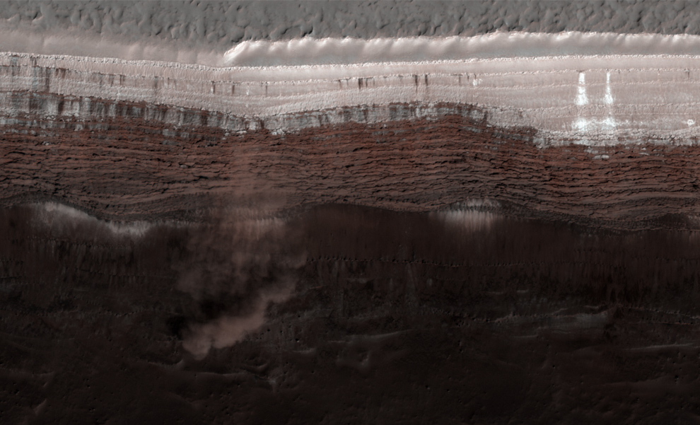
6 Avalanches on Mars' North Polar Scarps. Material, likely including fine-grained ice and dust and possibly including large blocks, has detached from a towering cliff and cascaded to the gentler slopes below. The cloud is about 180 meters (590 feet) across and extends about 190 m (625 ft) from the base of the steep cliff. More, or see location on Google Mars. (NASA/JPL/University of Arizona) #
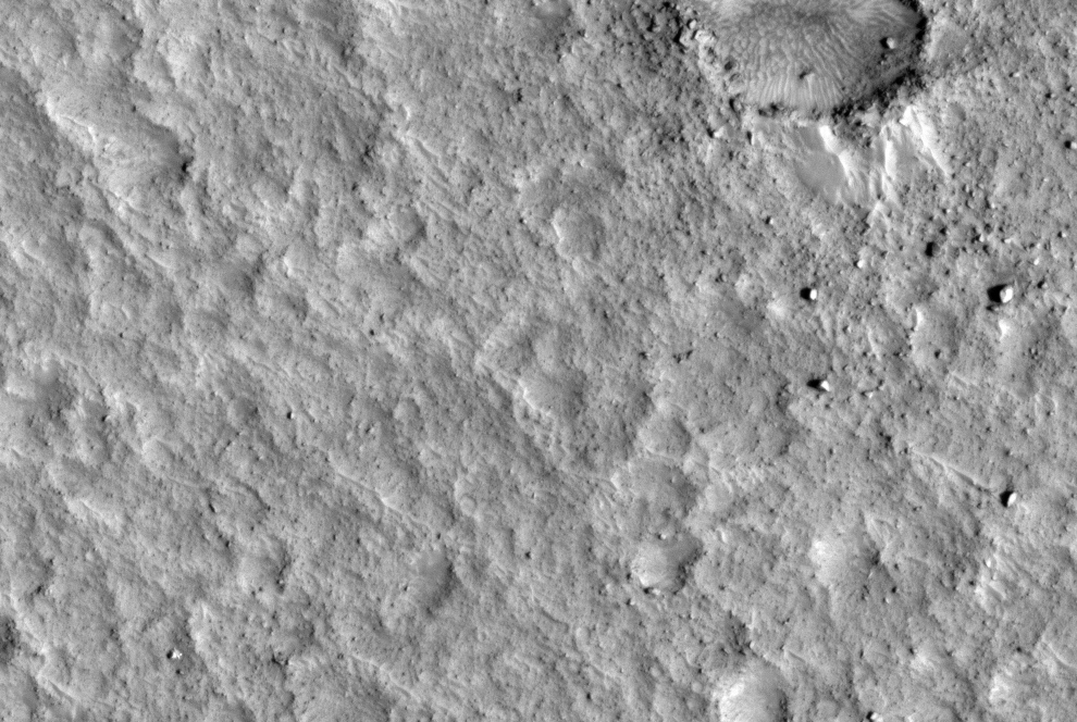
7 Pathfinder spotted on an ancient flood plain of the Ares and Tiu outflow channels. The bright spot visible at lower left is the Mars Pathfinder Lander, its ramps, science deck, and portions of the airbags visible. NASA's Pathfinder landed on Mars on July 4, 1997 and continued operating until September 27 of that year. More, or see location on Google Mars. (NASA/JPL/University of Arizona) #

8 Victoria Crater at Meridiani Planum. The crater is approximately 800 meters (about half a mile) in diameter. Layered sedimentary rocks are exposed along the inner wall of the crater, and boulders that have fallen from the crater wall are visible on the crater floor. NASA's Mars rover Opportunity explored this crater and its walls in 2006. More, or see location on Google Mars. (NASA/JPL/University of Arizona) #
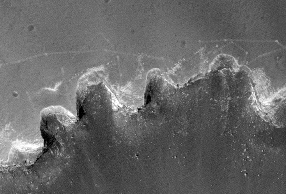
9 Close-up of tracks made by NASA's Mars rover Opportunity in the soil near Victoria Crater. More, or see location on Google Mars. (NASA/JPL/University of Arizona) #
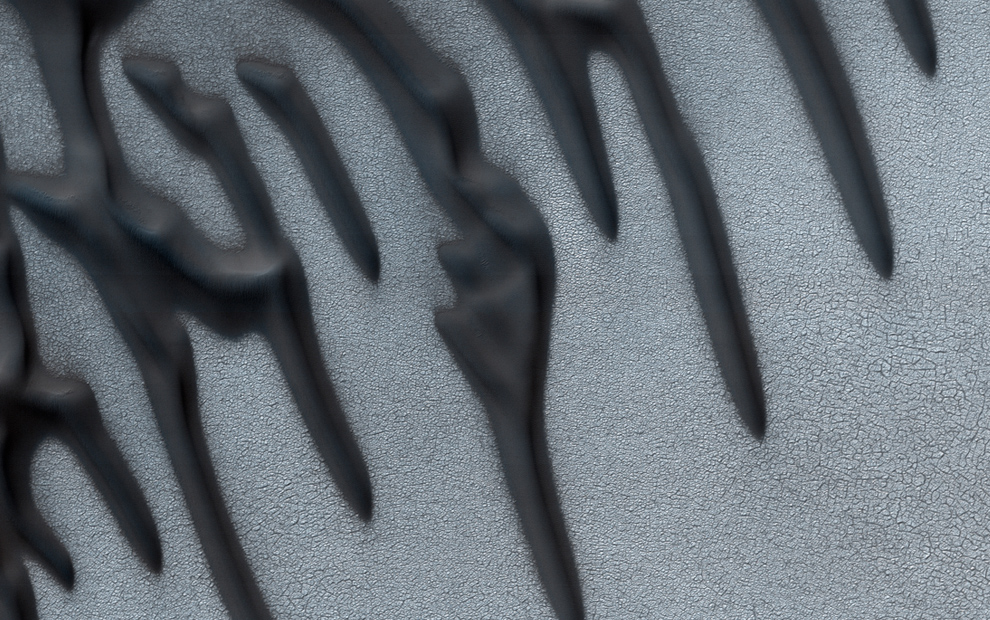
10 Linear dunes in the north polar region of Mars. Polygons formed by networks of cracks cover the substrate between the linear dunes and may indicate that ice-rich permafrost is present or has been present geologically recently in this location. More, or see location on Google Mars. (NASA/JPL/University of Arizona) #